Course Information
Be prepared to be impressed.
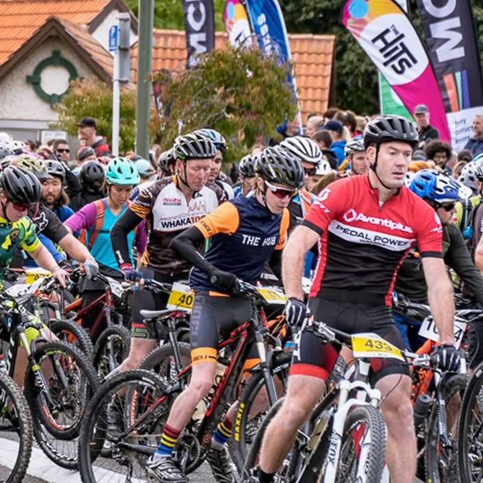
Starting and finishing in Havelock North village, MCL Construction TRIPLE PEAKS is an event for your bucket list!
Traversing Mt Erin, Mt Kahuranaki and iconic Te Mata Peak, the course will cross private land, and take in some incredible breathtaking Hawke's Bay scenery. The course is rugged, testing and very rewarding. Enjoy beautiful ancient woodland, craggy ridgetop views, scenic farmland, fun single track, gravel road and a few hearty crossings of the Tukituki River.
Solo '3 Peaks' Competitors - 55 kms
Solo '3 Peaks Challenge' competitors will complete the entire course. Please see below for details of the course. You can run, walk, MTB or E-MTB or enter the duathlon option.
Duathlon competitors will run Mt Erin, mountain bike Mt Kahuranaki and run Te Mata Peak.
Two Peak Tiki Tour - 37 kms
Two Peak Tiki Tour entrants will traverse Mt Erin (Kohinerakau) and Mt Kahuranaki only. Mostly private land!
You can choose to walk, run, MTB or E-MTB this course (no teams).
It is a considerable distance to cover 3 peaks 55 kms in one day and you MUST move swiftly in order to complete the full course, without being cut-off. If you are uncertain if you can complete 55 kms in under 10.5/11 hours, then we highly recommend you try this two peak option.
Note, if doing the Two Peak Tiki Tour, we do recommend that you organise your own transport from Rochfort Rd Transition after completing Mt Kahuranaki (your finish point). Some limited mini bus transport will be available. You will start with everyone else in the Village at 7.30am and will also need to collect a timing transponder at registration on the Friday night.
One Peak Explorer - 15 kms
You can choose to just complete Mt Erin (Kohinerakau) - a distance of 15 kms. If going solo for 55 kms doesn't spin your wheels, or you can't find a few buddies to do a relay team with you - then this is a great solution! Low-key and non-competitive. You can still explore private land, and be part of the buzz of the event!
See the below description for leg 1 for details of your course.
You will start with everyone else in the Havelock North Village Green. You can choose to run, walk, MTB or E-MTB. You must organise a support person to pick you up from the finish line (Transition Area). Limited free bus transport will be provided for those unable to find a support person.
You will also need to collect your ankle strap (timing device) from registration on Friday night.
Relay Teams
Choose from run, walk, MTB, E-MTB or Duathlon teams. Open category and Schools category.
Leg 1: MT ERIN (distance 15 kms - total elevation gain 597m)
Participants on leg 1 will depart Havelock North Village en masse, and be guided through the streets of Havelock North until reaching the hills. Then it's all go! Competitors will pass through historic Kopanga Station and Ben Gaddum's farm, and then enjoy a steady climb to the top of Mt Erin (489 m) (steep pinch near the top!), and then a fast, fun descent to the Tukituki River, at Rochfort Road.
VIEW LEG 1 HERE INC ELEVATION PROFILE
Leg 2: MT KAHURANAKI (distance 22 kms - total elevation gain 848m)
Participants on leg 2 will gently climb up from the Tukituki River transition (at 37m above sea level), across farmland (thus avoiding the tar sealed section). This is 5 kms of gentle ascent to 163m above sea level. Upon reaching the access road to Mt Kahuranaki, participants will travel up a further 5 kms to the 646m trig via the gravel farm track to the summit, where they will then enjoy a fun, fast descent back, around the south side (on a different route to the uphill track) back down to the River to cross at the same point as transition 1.
VIEW LEG 2 HERE INC ELEVATION PROFILE
Leg 3: TE MATA PEAK (distance 20 kms - total elevation gain 579m)
Participants on leg 3 will ''take the baton'' at the Tukituki River crossing, and then traverse beautiful farmland on the western side of the Tukituki. Upon reaching the base of Te Mata Peak, competitors will ascend to the 399m trig along beautiful single track, past the Giant Redwoods and Karaka Grove, and then weave their way back down to the Village through Hikanui Reserve, Tainui Reserve and Keith Sands Grove, enjoying impressive views, beautiful native forest and fun trails along the way.
VIEW LEG 3 HERE INC ELEVATION PROFILE
What happens if the river is too high to cross?
The contingency plan will be ready to go should we be unable to cross the Tukituki River. Plan B is to go up and down Mt Erin twice on 4 different routes, of which the access road will be used only once. If needed this will be a really good fun route, and will be on trails never experienced before.
Following the descent to the Tukituki River, from Mt Erin, we will proceed on the western side of the river to Te Mata Peak, where we will continue the course as detailed above, and then back to the Village.
Distances for Plan B course: Leg 1 - 17 kms, leg 2 - 15 kms, and leg 3 - 13 kms
The transition points will be different for the Plan B course. The first transition would be located in a paddock off Middle Road, just before the Mutiny Rd turnoff. About 10 mins from Havelock North. Transition 2 would be located along Matangi Road, off Waimarama Rd (behind Te Mata Peak). If we had to resort to plan B, full course information will be provided in advance of the event.
Maps
FULL OVERVIEW OF PLAN A COURSE - HERE
Plan A Course Maps
Leg 1 - Mt Erin - UP map DOWN map
Leg 2 - Mt Kahuranaki LINK map (out and back) UP and DOWN map
Leg 3 - Te Mata Peak UP and DOWN map
***Plan B Course Maps (i.e. in case the river is too high to cross)
Leg 1 - Mt Erin A UP map DOWN map
Leg 2 - Mt Erin B UP map (note that this route will only be used if it's in good condition - otherwise we will go up the gravel access road) DOWN map (except the river crossing, but includes part of below 3rd leg, along Tukituki River)
Leg 3 - Te Mata Peak UP and DOWN map
Cutoff Time
Please note: There will be a cutoff time at Transition (before the start of leg 3). This will be approx 8 hrs (3.30/4pm). If a competitor does not reach this area by this time, they will be transported back to the finish line (if you are a solo who has entered 3 peaks, then your time will be moved in to the 2 peak category).
Transition Points
Those competitors in a relay team who are doing the 2nd and 3rd legs must make their own way to the transition point at Rochfort Road, off Kahuranaki Road. This will be easily accessible by car, and plenty of parking will be available. No buses will be provided. Live entertainment and coffee cart to enjoy. The distance from the Centre of Havelock North is 21 km and takes 25 minutes to drive. Map and description to Transition click HERE.
(note that the Transitions Points will be in different locations if we are forced to go with the Plan B route if the river is too high to cross)
Duathlon competitors - solo and teams
Please note that duathlon competitors will begin the event running up and down Mt Erin. They will then pick up their mountain bike at the transition area by the Tukituki River (click HERE for direction). It is essential that your support person drops off the bike at transition. Organisers will not be responsible for delivering your bike to transition. If you do not have a support person, please contact the organisers for assistance. Following the bike leg up Mt Kahuranaki, competitors will then transition to running, and run the final leg up Te Mata Peak. Your support person will need to take your bike away, to meet you at the finish. This duathlon structure can also be enjoyed by teams of 2 to 3 people, as well as solo.
Bag Drop
Note that there will be a BAG DROP made available to all those completing the event, which will be available for collection at Matangi Road (7 kms after the start of the Te Mata Peak leg). You will drop off your bag (please tag it yourself) to the yellow box on Sat morning at event start. Details about this will be provided to all entrants in email communications.
Directional Signage
Large red arrows will be strategically placed around the course to ensure you do not get lost. The directional signage will be clear and easy to navigate.
Event Preparation
MCL Construction TRIPLE PEAKS is a challenging event that should not be underestimated. The hills are steep and some of the terrain is technical. You WILL be challenged!
For those mountain biking, please be prepared to carry your bike on a few short sections. There may be gates and fences to climb over. And you will need to dismount your bike for the river crossing, and be prepared to get wet!
Whilst the terrain is picturesque, it is also exposed in places. You could experience strong winds, rain or blistering sunshine. We encourage competitors to be well prepared with suitable clothing, food and water. You may consider taking a hat, sunblock, electroytes and your mobile phone (in a sealed bag).
For more details on TRAINING for both the solo and team categories, please CLICK HERE
Training & land access
Whilst it is essential to undertake plenty of training prior to the event, it is very important that you do NOT attempt to access the private land that will be used for much of the course. This is very important. If competitors are found to be accessing private land in advance of the event, the individual involved (and their team) will be disqualified.
We are very grateful to the landowners for entrusting us with accessing their land. Please treat it with respect.
Aid Stations
Whilst we do encourage you to bring your own water and food, Aid Stations will be provided in strategic locations. There will be an Aid Station at the Transition Area, at Rochfort Road (HERE). It will be well stocked with water and bananas / lollies. At the top of the 3 summits, you will also find water and bananas. And, at Matangi Cattle Yards, prior to the ascent of Te Mata Peak, you will also find an aid station with lollies and water, thanks to the team at Hillmac Electrical. Please bring sufficient water for yourself and treat our supplies as backup.
The Salvation Army are kindly assisting us with water supplies, with a 1200 litre trailer at transition, and a water truck at the top of Te Mata Peak. Marshalls will man water stations at the top of Mt Erin and Mt Kahuranaki. Please fill up a water bottle / bladder directly. No cups provided. Better for the environment!
Medical Attention
If you require medical attention, please talk to the nearest marshal, who will refer to you the event director and medic. All medical situations should be channelled through the Event Director only. A medic will be available on each of the 3 peaks, as well as a medic team at the Finish Line and Transition Area. If you are competing and see someone who is injured, please be considerate, and stop to assist. As the course is not always easily accessible, part of the safety plan is that we look after each other.
Roads are Open
Please note that, whilst you will spend a very short time on public roads, the roads will still be open to traffic (apart from the top of Te Mata Peak). You MUST obey the road rules and you MUST obey directions given to you by marshals. Any issues will result in disqualification.
Race Regulations
Please READ the Race Regulations.
It contains vital advice and information that is relevant to ALL competitors.
Extreme Weather
In the unlikely event of Force Majeure or Extreme Weather conditions, the event may be cancelled at any time. We will communicate this to all participants via email, the website and Facebook. In this situation entry fees are non-refundable.** Best endeavours will be made to re-schedule the event. If the event is re-scheduled and you are unable to attend on the new date, your entry fee will not be reimbursed.
*** Covid 19 policy is separate. Please view it HERE.
Note 1
The course description is subject to change and should be referred to as a guide only.
Note 2
Competitors must remain on the course at all times, and must not deviate from the marked tracks. Gates / fences and other items on the land must not be tampered with, and all rubbish must be removed.